


The perfect destination to experience the Pyrenees in every season
What to do in Sort?
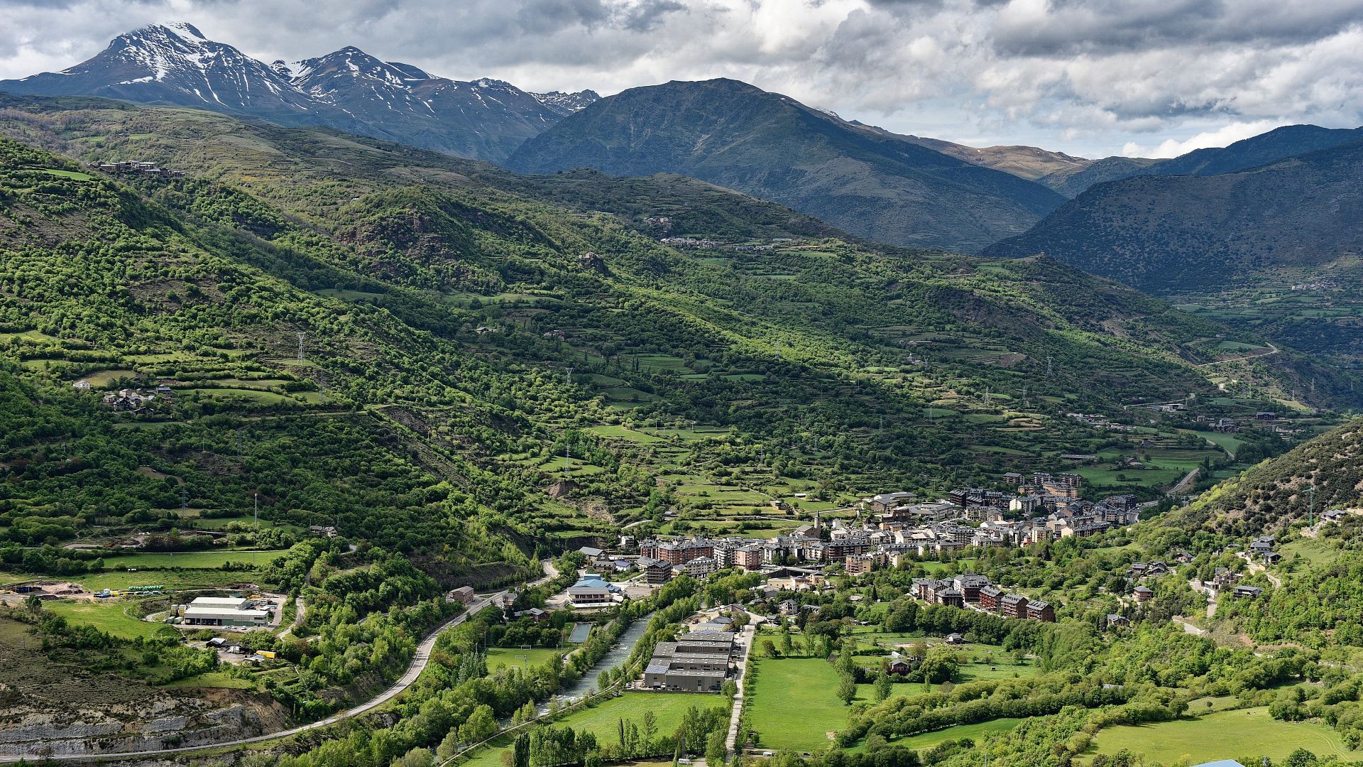
Staying at Hotel Les Brases means discovering Sort, the capital of Pallars Sobirà and the epicenter of adventure tourism in the Catalan Pyrenees. Surrounded by nature and connected to ten unique valleys, the town is ideal for activities such as rafting, skiing, hiking, and horseback riding, in addition to its lively gastronomic and cultural offerings.
Just 50 minutes from Andorra and Vielha, and a few steps from the famous “La Bruixa d'Or” lottery, Sort is the perfect destination for a holiday with family, as a couple or with friends.
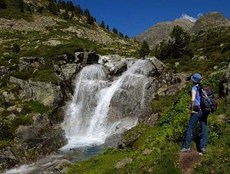
Aigüestortes
It's one of the 14 parks in the country. The only one you can visit in Catalonia. It's one of the Quaternary glaciers that repeatedly covered Europe.
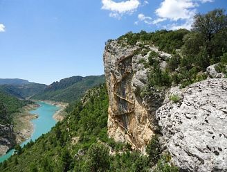
Congost de Mont Rebei
The Congost de Mont-rebei or Mont-rebei Gorge is a spectacular route carved into the Montsec mountain range by the Noguera Ribagorzana River.
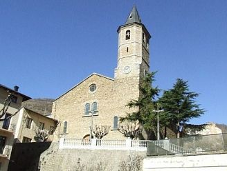
Sauri Church
An idyllic village located at the bottom of the Àssua Valley, on the banks of the Pamano ravine, where the Moix family had spent their summers in the late 1960s.
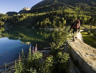
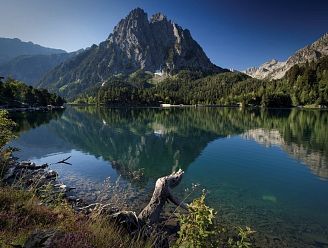
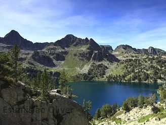
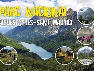
Aigüestortes and Saint Maurice
One of Catalonia's greatest natural treasures is the Aigüestortes and Lake Sant Maurici National Park, the only national park in our region.

Lakes Train
Unique journeys on the Historic Lakes Train from Lleida to Pobla de Segur. This is a nostalgic journey that transports you back in time.
Passion for the Pyrenees
Pyrenees Passion is the first brand that brings together people passionate about their work, their business, their mountains, and most importantly, giving their all to the people of the country and to tourism.
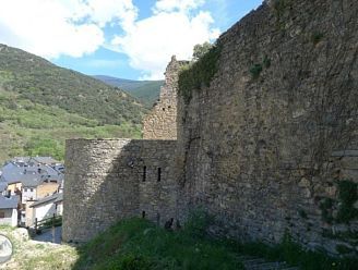
The castle of Sort
The town of Sort (692 m altitude), the center of the Pallars Sobirà, extends at the bottom of the valley, on the right bank of the Noguera Pallaresa.
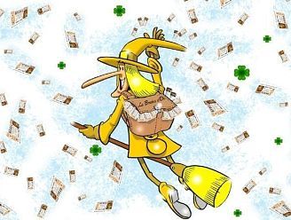
The Golden Witch
Sort is a charming little town in Lleida, also known as "the town of luck." It's a pleasant tourist destination where you'll find fun activities that will make for a pleasant experience.
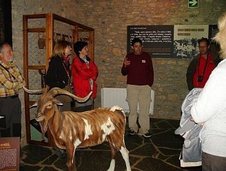
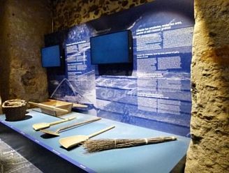
Museum of the Shepherds
The Àssua Valley Shepherds Museum, after a short presentation of the valley's characteristics, explains the different tasks that shepherds must perform.
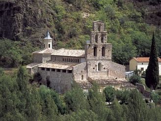
Monastery of Santa Maria
It was one of the richest monasteries in the Bisbat d'Urgell, and among its numerous and extensive heritage, salt and salt mines stand out, a key element in medieval times.
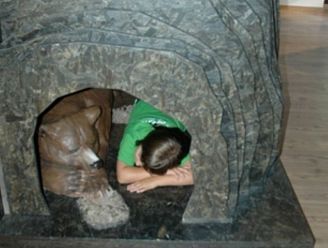
Bear Museum
This interpretation center, located in Isil, allows us to learn about the brown bear and its life in the Catalan Pyrenees. It has become the first interpretation center for this animal in Catalonia.
Salt Museum
The Gerri de la Sal Museum is located in the former salt warehouse. The building consists of a roughly square floor plan of 650 m2 per floor, with three floors and an attic.
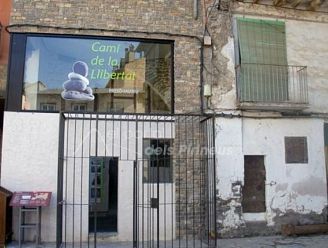
Prison Museum of Freedom
The Freedom Trail is the name given to the route that passed through Sort, which was used by approximately 70,000 to 80,000 people fleeing the Nazi regime during World War II.
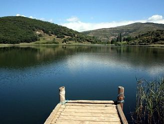
Lake Montcortés
This beautiful lake is of karst, not glacial, origin and is the only lake of its kind in the Pyrenees. It has a perimeter of 1,320 m and covers an area of 43 hectares.
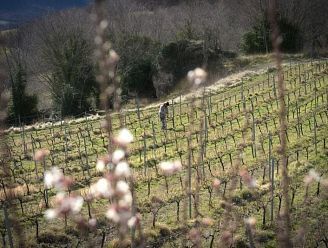
Batlliu de Sort Winery
Five friends, passionate about wine and Pallars Sobira, wanted to revive wine production in the municipality of Sort and revive an activity that had been lost for two hundred years.
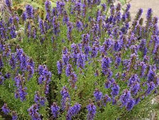
Herbs of the High Pyrenees
At the Herb Garden of the Alt Pirineu, they are lovers of the earth and plants. Here you will find a large number of diverse herb species.
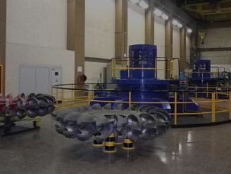
Hydroelectric power plant
The Tavascan Interpretation Center was created to showcase a crucial aspect of the modern history of electricity in Catalonia: the construction of the Alt Cardós Valley hydroelectric complex in the 1960s and 1970s.
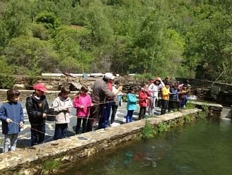
Fish farm
In the heart of the High Pyrenees Natural Park and very close to the Aigüestortes and Estany de Sant Maurici National Park, the Tavascan Fish Farm maintains a close connection between the environment and agriculture.
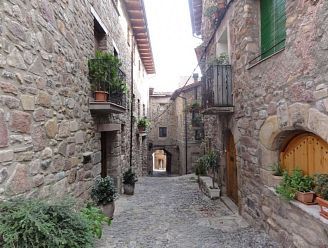
Sort's old town
The historic center of Sort, made up of narrow streets and houses made of stone, wood, and slate, gathers at the foot of a rocky spur where the large circular towers are located.
Les Vernedes
The Sort and Vall d'Àssua Nature Trail is made up of a series of routes arranged around a main path divided into six sections, between the towns of Sort, Olp, Altron, Sauri, Llessui, Les Bordes de Llessui and Pas de Mainera.
Gerber Lake
The Vall de Gerber, of glacial origin, is located on the northeastern edge of Aigüestortes, near the town of Esterri d'Àneu (Pallars Sobirà).
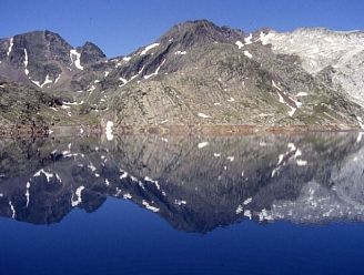
Certascan
Certascán or Sertascán Lake is a glacial lake located at an altitude of 2,236 m, at the head of the Cardós Valley (Pallars Sobirà), east of the Certascan peak (2,853 m high).
Boet Square
The Pla de Boet is a large grassy plain in the Boet Valley, surrounded by a cirque of forests and mountains. It sits at an altitude of 200 m. The Baiau River winds and lingers there, and mares, cows, and sheep often graze there.
Medieval village
Vila closa de Peramea i l'Era d'Ortega shows the most characteristic urban features of what we could describe as a medieval enclosed village, a type of compact, grouped settlement, closed in on itself, in which the walls of the houses themselves serve as walls.
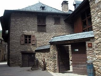
Ecomuseum of the Àneu Valleys
In June 1994, the Ecomuseum of the Àneu Valleys opened to the public. Today, this institution is a living entity that aims to participate in and influence the economic and social development of the Àneu valleys.
Rural tourism in Lleida
Authentic "rural tourism in Lleida" can be found in the surrounding areas along the Noguera Pallaresa River and the Aigüestortes National Park, in the heart of the Pallars Sobirà region.
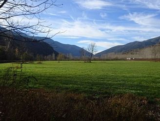
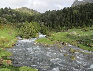
Boavi Plain
The Pla de Boavi is a perfect place to rest and relax, surrounded by beautiful scenery. Surrounded by large mountains, there are several streams that eventually become part of the Noguera de Cardós River.
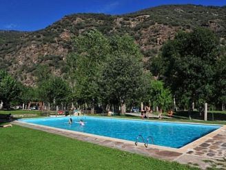
Hotel with swimming pool
The campsite's swimming pool is included in the price for hotel guests. The pool is 200 meters from the hotel and is open in summer from June 24 to September 12.

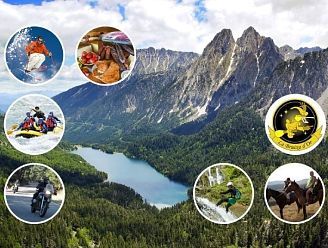
Route 260
Enjoy traveling on your motorcycle against a backdrop of colorful landscapes and wonderful roads. Here are the best routes to take, featuring landscapes, cuisine, the Pyrenees, and culture. Fully detailed routes with time, mileage, points of interest, gas stations, and more, created just for you, you won't be able to stop smiling.